Air Navigation Basics for CPL Students – A Complete Beginner’s Guide
Preparing for your DGCA Air Navigation exam? This complete beginner’s guide explains pilot navigation basics — from latitude & longitude to VOR, DME, dead reckoning, and GPS.
Wind Correction Angle and Ground Speed – Flying Through Moving Air
Here is something many non-pilots don’t realize: when a crosswind is blowing, an aircraft pointed directly at its destination will be pushed sideways and end up somewhere else entirely. This is called drift, and to correct for it, the pilot applies a Wind Correction Angle (WCA).
The WCA is the number of degrees a pilot must angle the aircraft into the wind to maintain the desired track over the ground. The Wind Triangle is the graphical method used to calculate it — and the CRP-5 navigation computer is the tool used to solve it quickly.
Once the WCA is applied, the pilot now flies a heading that looks different from the desired track. The actual speed over the ground — accounting for the tailwind or headwind component — is called Ground Speed (GS), and it may be higher or lower than the aircraft’s airspeed depending on wind direction.
The Wind Triangle is widely considered the most tested and most feared numerical topic in the DGCA Air Navigation exam. Practice it daily. No shortcuts exist here.
Dead Reckoning Navigation – The Pilot’s Original GPS
Long before GPS, pilots relied entirely on Dead Reckoning (DR) to navigate — and DGCA still examines it comprehensively because it forms the intellectual foundation of all navigation.
Dead Reckoning works like this: If you know your starting point, your heading, your airspeed, the wind acting on the aircraft, and the time elapsed, you can calculate where you must be — without any external reference.
The key elements of DR are:
- True Airspeed (TAS) — the aircraft’s actual speed through the air
- Wind Velocity — direction the wind is blowing from, and its speed
- Heading — the direction the aircraft is pointing
- Track — the actual path over the ground
- ETA — Estimated Time of Arrival, calculated using GS and distance
DR navigation is the foundation of flight planning, fuel calculations, and alternate selection — all of which appear not just in ground exams but in real-world airline operations.
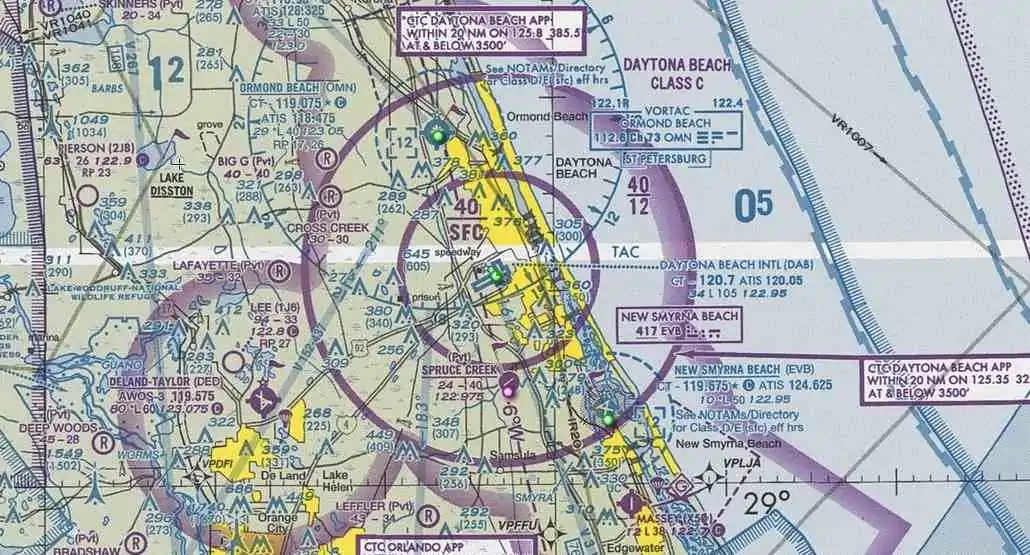
Radio Navigation Aids – VOR, DME, and NDB
As aviation evolved, ground-based radio systems were developed to help pilots navigate more accurately. These are the radio navigation aids covered in the CPL navigation syllabus.
✈️ VOR – VHF Omnidirectional Range
VOR is the most widely used radio navigation aid in aviation today. A VOR station transmits radio signals in all 360° directions — called radials — from the station. A pilot can determine exactly which radial they are on by tuning to the VOR frequency and reading the Omni-Bearing Selector (OBS) instrument.
VOR operates in the VHF band (108–117.95 MHz) and is a cornerstone of IFR navigation worldwide. The DGCA exam tests both the operating principles and practical applications of VOR extensively.
✈️ DME – Distance Measuring Equipment
DME works by sending a signal from the aircraft to a ground transponder, which replies. By measuring the time taken for the reply, the aircraft’s avionics calculate the slant range distance to the station in nautical miles.
DME is often co-located with VOR stations (forming a VOR/DME pair), and together they provide a complete position fix — bearing AND distance.
✈️ NDB – Non-Directional Beacon
The NDB is an older, simpler radio navigation aid that transmits an omni-directional signal. The aircraft uses an Automatic Direction Finder (ADF) to point a needle toward the NDB station. While being gradually phased out in modern aviation, NDB and ADF remain important topics in the DGCA exam and still operate at many airports in India.
Modern Navigation – GPS and Beyond
GPS (Global Positioning System) has fundamentally transformed aviation navigation. Using a constellation of satellites orbiting Earth, GPS provides aircraft with extremely accurate position, speed, and altitude data — continuously, globally, and in all weather conditions.
In modern aircraft, GPS feeds into the Flight Management System (FMS), which integrates navigation data with performance calculations and autopilot systems. Concepts like RNAV (Area Navigation) and RNP (Required Navigation Performance) — both based on GPS — are now standard in commercial airline operations and are covered in the advanced section of the DGCA CPL navigation syllabus.
For CPL students, understanding GPS fundamentals, its limitations (signal errors, jamming susceptibility), and how it complements traditional radio navigation is increasingly important in today’s aviation environment.
Common Mistakes Students Make While Studying Air Navigation
Understanding the pitfalls is half the battle. Here are the errors that cost students marks in DGCA exams:
🔴Confusing True Course with Magnetic Heading — applying variation in the wrong direction is one of the most frequent mistakes.
🔴 Making errors in wind triangle calculations — wrong sign convention for drift, or mixing up TAS and GS.
🔴 Unit conversion errors — forgetting to convert knots to km/h, nautical miles to statute miles, or minutes to hours.
🔴 Ignoring chart details — misreading scale, airspace boundaries, or reporting points on navigation charts.
🔴 Rushing through numerical problems — Air Navigation exam questions require methodical, step-by-step working. Skipping steps leads to wrong final answers.
🔴 Underusing the CRP-5 — Many students study the theory but don’t practice enough with the navigation computer. The CRP-5 must become automatic.
Tips to Prepare Effectively for DGCA Air Navigation Exams
Here is a practical, week-by-week DGCA navigation preparation strategy that actually works:
✅ Weeks 1–2: Build the foundation — latitude/longitude, time conversions, chart reading, basic direction and magnetism
✅ Weeks 3–6: Master the CRP-5 navigation computer through daily wind triangle and time-speed-distance practice (minimum 10–15 problems per day) and Projections etc.
✅ Weeks 7–9: Study radio navigation aids thoroughly — VOR, DME, NDB, ILS, etc. — including working principles and usage
✅ Week 10-12:Study Instruments thoroughly Pressure instruments,Gyroscope instruments etc. including numericals.
✅ Week 12-13: Do Flight Plan, Mass and balance and Performance
✅ Week 14 onwards: Solve complete DGCA-style mock papers under strict time conditions (2.5 hours for 100–120 questions)
✅ Final Week: Revise formula sheets, common error traps, and shortcut methods only
Remember: Air Navigation rewards students who practice consistently. It is not a subject you can cram in the final week before the exam.
How Structured Ground Training Makes Air Navigation Easier
The students who clear DGCA Air Navigation in their first attempt share one common pattern — they did not study alone in isolation. They learned from experienced instructors who could explain the Wind Triangle with a diagram in two minutes, who could show them the exact error pattern DGCA examiners look for, and who pushed them through timed mock tests week after week.
That is exactly the kind of environment that Captain Preeti Aviation Classes (CPAC) in Indore has been building for students across India. With a training philosophy built on deep conceptual understanding rather than rote memorization, CPAC’s structured Air Navigation program takes students from zero knowledge to exam-confident — covering every module of the CPL navigation syllabus systematically.
Whether you are in Indore or anywhere in India, CPAC’s online and offline ground classes ensure that geography is no longer a barrier to world-class DGCA exam preparation. Experienced instructors guide each student through the Wind Triangle, chart reading, radio navigation aids, and full-length mock test series — building the kind of confident, thorough knowledge that translates directly into exam results.
📌 Prepare for DGCA Exams with Captain Preeti Aviation Classes (CPAC)
“At CPAC, we don’t just teach you to memorize books — we teach you to understand aviation like a real pilot.”
— Captain Preeti Mehadia, Founder & Chief Ground Instructor, CPAC
If you are serious about building a strong foundation in DGCA Air Navigation and all CPL ground subjects, CPAC offers India’s most student-friendly, structured, and result-oriented ground training program.
🎯 What CPAC Offers:
| Feature | Details |
|---|---|
| 📚 Subjects Covered | PPL • CPL • ATPL • RTO (R) |
| 🖥️ Mode | Online + Offline Ground Classes |
| 👩✈️ Experience | 16+ Years of Aviation Teaching |
| Instructor Expertise | Experienced aviation faculty for DGCA subject preparation. |
| Training Focus | Concept-based DGCA ground training with student guidance. |
| Support | Computer Number, medical planning, flying school guidance and type rating readiness. |
📞 Connect with CPAC Today
https://cpacpilots.com
+91 7999854151
cpacpilots@gmail.com
📍 Location: Indore, Madhya Pradesh — serving students Pan-India through Online Classes
✈️ Your aviation journey begins on the ground. Make sure you build it right. Enroll at CPAC today and take your first confident step toward the cockpit.
Frequently Asked Questions (FAQs)
1. Why is Air Navigation considered the toughest subject in DGCA CPL?
Air Navigation is calculation-heavy and requires strong conceptual understanding. It involves wind triangle, time-speed-distance, and flight planning numericals, which demand accuracy and regular practice.
2. What is the most important topic in DGCA Air Navigation?
The Wind Triangle is the most important and frequently asked topic. It is used to calculate Wind Correction Angle (WCA), Ground Speed (GS), and heading, and forms the base of many exam questions.
3. How can I prepare effectively for Air Navigation?
Start with basic concepts like latitude/longitude and time conversions, then focus on CRP-5 practice daily. Solve numerical problems consistently and attempt mock tests under exam conditions.
4. What is Dead Reckoning in aviation?
Dead Reckoning is a navigation method where a pilot calculates position using known speed, heading, wind, and time without external references. It is fundamental for flight planning.
5. Is GPS enough for modern aviation navigation?
While GPS provides accurate and reliable navigation, pilots must still understand traditional navigation methods like VOR, DME, and Dead Reckoning as backup and for DGCA exams.
